Flood Control
As storms and natural disasters increase in severity and frequency, additional focus has been placed on early warning and monitoring system.
The choice of commercially available products that combine the best of power management, sensor integration, and communications are limited or non-existent.
Other government based satellite systems deliver information with latency that can range between 15 minutes and 4 hours which would be inadequate for flash-flooding conditions.
Gotham Analytics can provide reporting frequency under 5 minutes, which is preferable and required in some cases.
Hydrologic/Hydraulic Modeling
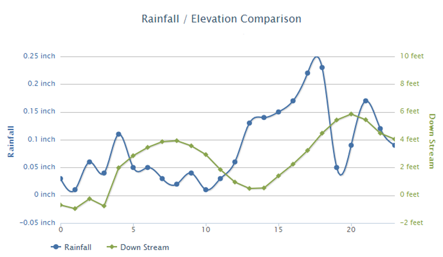
Streamflow modeling is an integral part of the AquaEdge System. Gotham Analytics has the ability to correlate rainfall data and water surface elevations into predictive flood maps. State-of-the-Art hydrologic and hydraulic modeling software is used to define the flood levels in flood prone areas. Rainfall hyetographs are used to determine the amount of runoff, and rainfall forecasts are used to predict the extent of flooding that is likely to occur. These models are calibrated with known rainfall and runoff to refine the accuracy of the model. Localities that experience frequent flooding can use this predictive approach to determine areas that should be evacuated and to enhance emergency operations.